1. Relief/Orographic/Mountain rainfall
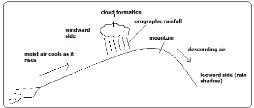
Rain experienced on the windward slopes of mountains or hills formed when moist air is forced to rise over a mountain or a hill.
How it Forms
- Moist air is forced to rise over a hill or mountain.
- The temperature and air pressure decreases making it to expand.
- Air cools due to decreased temperature and decreased pressure causing it to expand.
- Moisture condenses forming tiny water droplets (clouds).
-The tiny water droplets in clouds merge and become too heavy to be suspended in air and fall as rain.
- Air proceeds to the leeward side with low moisture content.
- Since its heavier due to being cool it descends over that side and gets warmed making it to hold onto the little moisture it had causing that side to receive low rainfall (rain shadow).
1. Convectional Rainfall
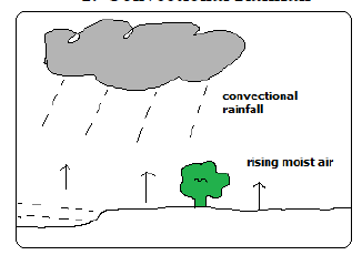
It’s accompanied by thunderstorms.
How it forms
- Ground or water body is heated causing evaporation.
- There is convective rising and cooling of moist air.
- Condensation takes place forming tiny water droplets (clouds).
- The droplets merge and fall as rain.
- The cooled dry air descends to the surface where its heated and its capacity to hold moisture is increased.
- The process is repeated.
2. Frontal/Cyclonic Rainfall
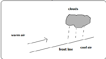


Type of rainfall common in mid-latitudes formed when warm air blows towards a cold area or when warm air mass meets with a cold air mass.
It’s accompanied by cyclones (violent winds).
How it Forms
- Warm moist air mass meets with a cold air mass.
- The warm air is forced to rise as it’s less dense.
- It cools as it rises at the line of contact with cold air.
- The moisture condenses forming clouds resulting in frontal rain.
marto answered the question on
March 22, 2019 at 08:24